
Enfield ZIP Labels and Coverage
USPS material gives Enfield two postal entries, but the entries do not serve as a ready-made neighborhood map. The official table lists 06082 ENFIELD CT 06082 and a second line for 06083 ENFIELD CT 06082. That wording is why an Enfield ZIP code directory needs a delivery-point check. The postal table places both entries in a broader routing context associated with Broad Brook CT 06016 FSS. It does not prove that all Enfield mail is handled by a particular physical post office.
| ZIP | Areas Covered | Post Office | Notes |
|---|---|---|---|
| 06082 | Enfield label shown by USPS; validate each street address, unit, and ZIP+4. | Not established by the cited USPS routing table | USPS label material identifies ENFIELD CT 06082. Historic sections and modern survey labels still need a separate address check. |
| 06083 | USPS label entry shown; exact street, box, or boundary coverage was not established. | Not established by the cited USPS routing table | The Postal Bulletin pairs the entry with ENFIELD CT 06082 in a broader Broad Brook FSS context. Do not treat it as a physical post-office claim. |
The safe reading is narrow. A ZIP code can point to a carrier route, a box service, or a geographic delivery label. It does not identify a resident, prove that a parcel lies in a particular historic section, or replace a street address. The USPS Postal Bulletin table is useful for the label, while the live USPS lookup is the better check for one address.
The distinction matters in Enfield because the town’s historic vocabulary includes Enfield, Thompsonville, Hazardville, and Scitico, while modern community surveys add labels such as Southwood Acres and Crescent Lake. Those names can help a researcher orient a record, but none is a USPS ZIP boundary.
The USPS address tool shows the three search modes that make a postal check reproducible.
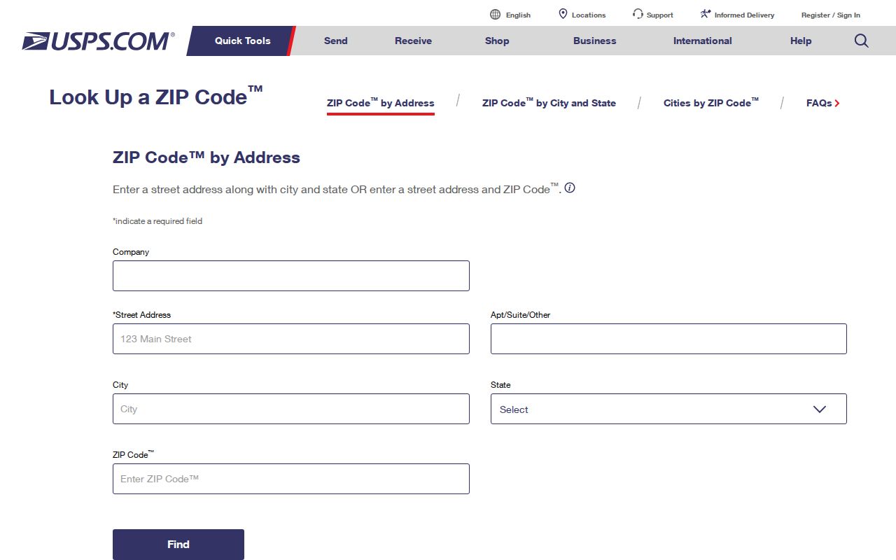
The form separates an address check from a city-and-state check and from a ZIP-to-city check, which keeps postal validation distinct from a resident search.
Enfield ZIP Fields for USPS Addresses
USPS gives a ZIP code search more structure than a single blank box. The By Address mode is for a delivery point. By City and State helps test a place label, while Cities by ZIP works in the other direction. Use the narrowest mode that matches the question and keep apartment or suite information separate from the street line.
| USPS field | Required | What the Enfield search uses it for |
|---|---|---|
| Company | Optional | Organization line in an address lookup; leave blank for an ordinary personal address. |
| Street Address | Required | Full street line for By Address validation. |
| Apt/Suite | Optional | Unit detail that can change a delivery result. |
| City and State | Required | Location fields for a By Address search. |
| ZIP | Optional | Candidate five-digit value in By Address; Cities by ZIP uses five digits. |
A returned postal match tells you how USPS standardizes the delivery point. It does not say who receives mail there, who owns the parcel, or who occupies it. Those questions move to the Town Clerk, Assessor, GIS, or a lawful historical source.
Enfield ZIP Filters in Court Records
Connecticut’s Civil Inquiry property-address search is the clearest inspected records portal with a ZIP field. It is not a residents list. The form asks for case type and city or town, then allows a partial street, full five-digit ZIP, property type, and case status. Foreclosure and summary-process cases have different coverage rules, and the court display is not the official file.
For a careful Enfield search, enter the town first, use the ZIP only to narrow the property-address results, then read the case category and status. A party name in a result is tied to a case role. It is not proof that the party lived at the address.
See the official Civil Judicial Property Address Search before relying on a field list. The screen captured for Enfield shows why a ZIP code directory should distinguish a postal lookup from a court-address lookup.
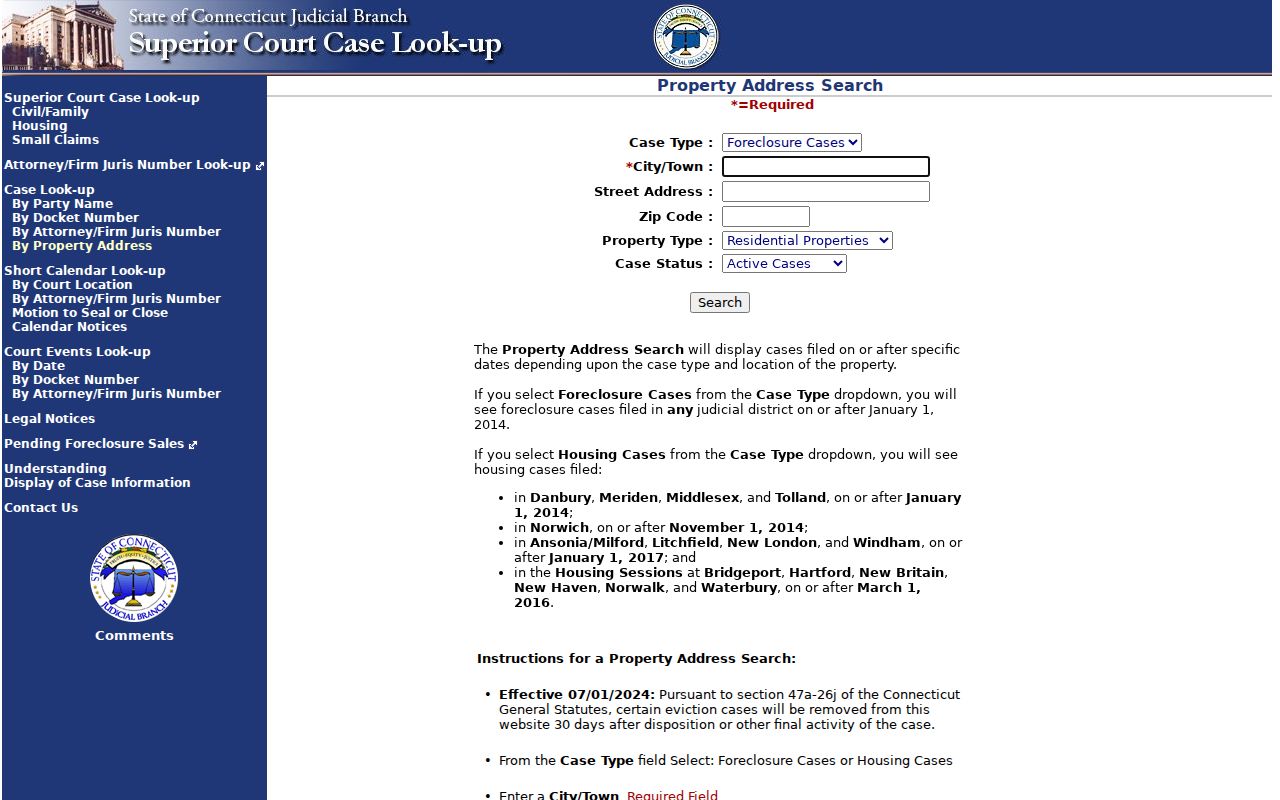
The court form adds legal context to an address filter, but its date limits and removal rules mean a missing result is not proof that no case existed.
Enfield ZIP Geography Is Not Village Geography
Enfield’s historic sections were shaped by roads, rivers, mills, churches, and village centers. Thompsonville’s carpet and rail history, Hazardville’s Scantic River industrial landscape, and Scitico’s older place identity all appear in maps and local collections. A modern ZIP label can touch that history without defining it.
The town’s neighborhood survey uses a different set of terms, including North Thompsonville, Green Manorville, Presidential, Whit Acres, and Crescent Lake. These labels describe community geography or self-reported location. They should not be turned into postal polygons without an official boundary source.
The official Enfield GIS Services page supports address and parcel work, abutter lists, labels, and map sharing. Its public material did not expose a simple ZIP boundary layer. Use GIS for parcel location, USPS for delivery validation, and the historical maps for place context.
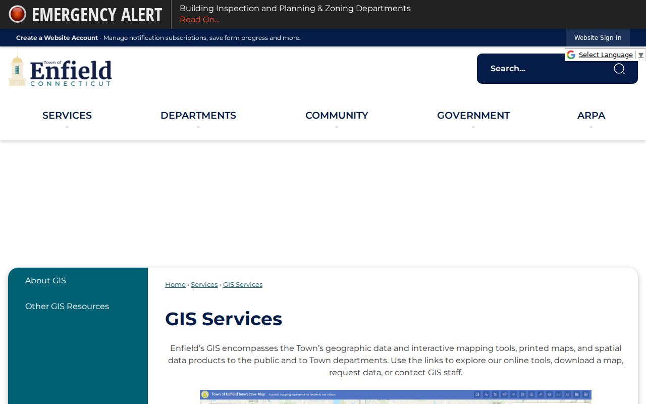
GIS can place an address within Enfield’s parcel and road system, while USPS answers how that same address is formatted for delivery.
Find Enfield Residents by ZIP
A ZIP-keyed resident search works best as a sequence of checks, not as a single claim. The postal result confirms the address format. Vision and GIS connect that address to a parcel and assessment card. Court, voter, vital, or historical sources answer separate questions with their own access rules.
- Validate the full address and ZIP in USPS, keeping the city label and unit information exactly as returned.
- Use Enfield GIS or Vision to confirm the parcel, situs address, owner field, mailing field, and parcel identifier.
- If the goal is a court-address question, use the Civil Inquiry ZIP field with the Enfield town and the right case type.
- For voter information, use the official SOTS lookup only for a lawful purpose and remember that safety suppression can hide a real address.
- For an election-related, scholarly, journalistic, political, or governmental need, follow the separate SOTS voter-file request process. The documented statewide file fee is $300, and the request must certify a permitted purpose.
- Once the ZIP narrows the search, move to the Enfield street directory for the address-keyed record chain.
The Connecticut Secretary of the State voter lookup is the public endpoint, but its fields were not readable during the unattended inspection. SOTS LEAD handles the full-file route. The form bars personal, commercial, advertising, solicitation, sale, marketing, and harassment uses, so it is not a casual ZIP directory.
For a local registration question, the Enfield Registrar of Voters is listed at 820 Enfield Street. The published hours are Monday, Tuesday, Thursday, and Friday from 9:00 a.m. to 1:00 p.m., with Wednesday closed. A local office visit or call is the fallback when the state form does not answer a status question.
There is no inspected Vision ZIP selector and no simple public GIS ZIP boundary filter. That absence is useful information. It keeps a ZIP search from promising a town-wide list that the official portals do not actually provide.
Enfield ZIP Boundaries and Town Limits
A ZIP code is a postal routing label, not a legal town line. In Enfield, the inspected USPS material does not publish a complete neighborhood polygon, ZIP population table, or verified split history. The safest result is address-specific: validate the delivery point, then use parcel and legal records for land geography.
The Town GIS information page warns that GIS data is representative and supplied as-is. That warning matters when a map is used to compare an Enfield ZIP with a road, wetland, district, or parcel. A map layer can aid orientation, but a survey, deed, or custodian record controls the legal question.
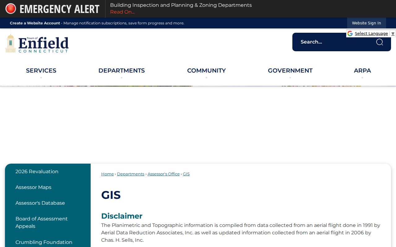
The GIS disclaimer reinforces the rule that postal, parcel, and legal fields should remain separate in any Enfield address comparison.
- ZIP code
- A five-digit postal routing label that groups delivery points for USPS processing.
- ZIP+4
- The four-digit extension that narrows a five-digit ZIP to a smaller delivery segment or point.
- PO-box ZIP
- A ZIP used mainly for post-office box delivery; it should not be treated as a street parcel area without an address result.
- Unique ZIP
- A postal code assigned to a single high-volume receiver or special delivery use, if USPS designates one.
- Carrier route
- A mail-delivery route inside a postal service area, not a town, village, tax, or neighborhood boundary.
The Postal Bulletin entry is the source for the two Enfield label lines and should be read with its routing context.
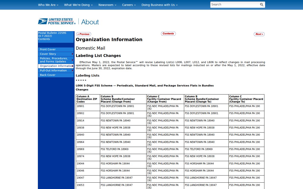
Its table is a starting point, not a substitute for the live USPS result for the address being checked.
Enfield Address Records Behind ZIP
Three address fields can look alike while answering different questions. A situs address names where the parcel sits. A mailing address tells where assessment or tax correspondence is sent, and it may be outside Enfield. A legal description, map reference, or parcel identifier ties a recorded interest to land. ZIP belongs to the postal layer.
When a name search returns an owner, keep the owner role separate from the mailing recipient and the occupant. The Enfield Vision card can show situs, owner or co-owner, mailing address, MBLU, account, PID, valuation, building, and sales fields. The Town Clerk index can add book/page, instrument, legal-description, and party links. A ZIP code alone cannot select which role is true.
That distinction protects both accuracy and privacy. It also lets a family historian preserve the address as printed in an old directory while storing the current USPS form in a separate field.
For the recorded-interest channel, use the Enfield land-record search portal and the Town Clerk's land-record information. The current town description places online coverage at November 1961 to the present, with maps online. Search and view are free, while an image can cost $1 per page plus a $2 service charge and may require login or payment. Before the online cutoff, use town deed books and maps, State Library or Archives material, microfilm, or a specific Clerk research request.
Enfield ZIP Data Gaps
No official inspected source supplied a complete Enfield ZIP boundary polygon, population table, voter count by ZIP, or public E911 address-assignment dataset. Those are research gaps, not facts to fill with a guess. A request for a statistic should state the geography, date, and source vintage.
If an address does not validate, try the exact street spelling, unit, city label, and ZIP in USPS before changing the town name. If the issue is parcel placement or address assignment, ask Enfield GIS, Planning, or Building Inspection. If it is a land or assessment question, use the Assessor or Town Clerk. If it is a court property search, read the court’s coverage and removal notice.
For a specific existing record that is not available through a portal, direct a narrow request to the holding agency through the Connecticut Freedom of Information portal. A request should name the record, date, address, and custodian. It cannot require an office to create a new ZIP boundary or resident count.
Practical check. A failed ZIP search can mean a bad unit, a routing label, a portal limit, or a missing boundary dataset. It does not by itself show that an Enfield address or person is absent.